MyEV Training Session
From creating an account to generating your first spatial farm map
On November 16th, we hosted a MyEV training session over zoom. Click HERE to see the recording of the session. The video covers…
How to set up a free account in MyEV
Building farm blocks and adding block-level information
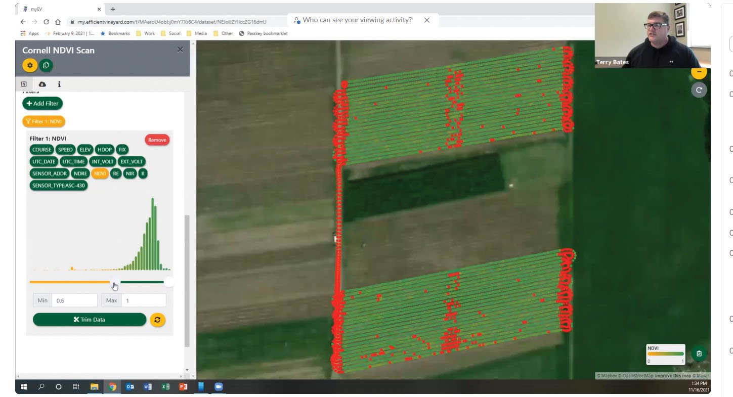
Importing and visualizing raw spatial data from an agricultural sensor.
Collecting and visualizing your own observations with a smartphone “Data Collector”
Performing simple data processing using the “Interpolator” Plug-in.